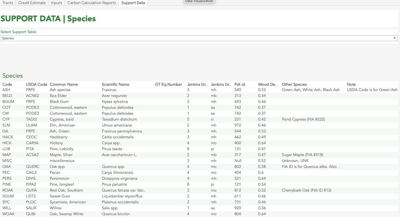
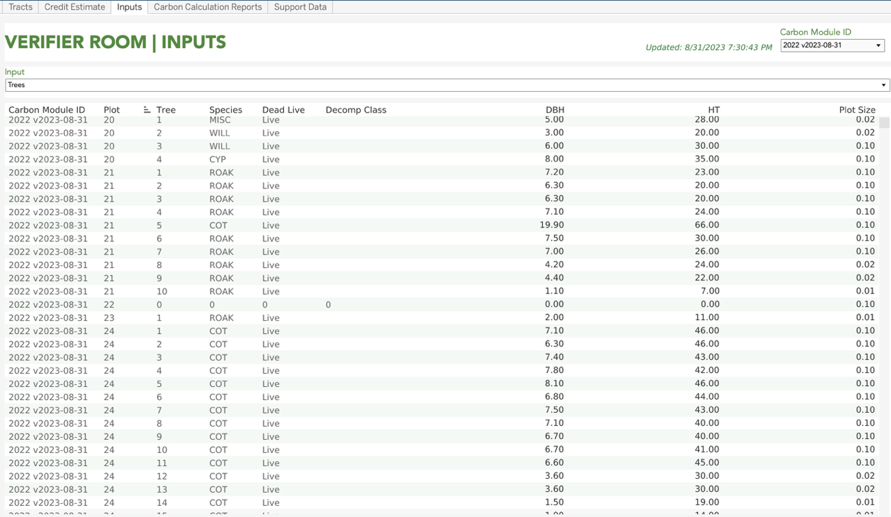
Apex Carbon Module for Enhanced Field Data Analysis
GreenTrees developed the Apex Carbon Module to code all the equations for carbon calculations. Data is ingested from the field and run through this model to calculate all the carbon calculation components. The GreenTrees Apex Carbon Module was reviewed, tested, and validated by Ruby Canyon.

The Future of Verification Has Arrived
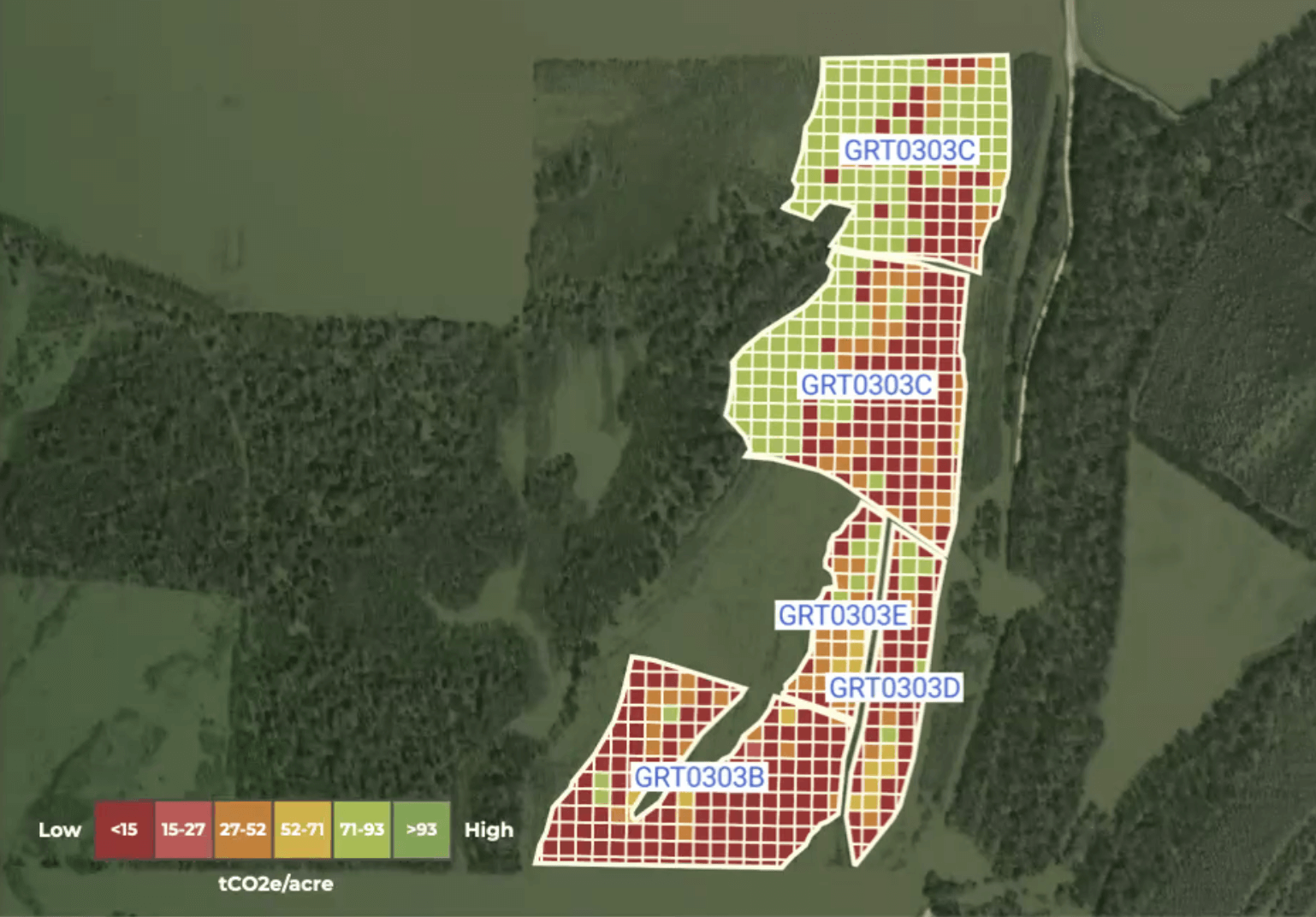
Leveraging 20 years of actual on-the-ground measurements, ACRE IO and its remote sensing partner has been able to deliver a digital monitoring verification reporting (DMRV) solution for the market. In 2022, all 136K acres of the most recent verification were flown using a tech stack that is rooted in LiDAR on fixed-wing planes to create a digital twin of every tree in GreenTrees. This involves nearly 75 billion data points. Training the algorithms through machine learning using the historical data set spanning two decades, AIO independently calculates the incremental growth of GreenTrees Carbon and do it within 2% accuracy of the on-the-ground measurements. Properties are divided into 25×25 meter patches and we have accumulated 970,000+ patches.